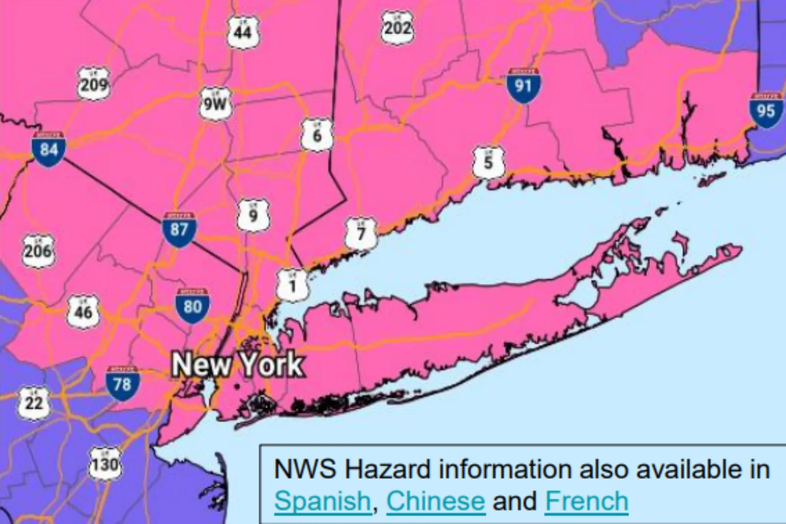
A new map from the National Weather Service (NWS) shows the overall weather forecast and winter storm warnings. Snow has reduced significantly, as have sleet accumulations for the area of New York and New Jersey.
A post on X from the NWS New York account read: “Due to a further northeast shift of mix precipitation, forecast snowfall totals around NYC and northeast NJ have been lowered.”
The forecast also shows that a glaze of ice has been added.
Despite this, the weather could still spell trouble for travellers. The NWS said that overnight travel will be “difficult” as the winter storm is still bringing heavy snow despite the reductions.
Alongside this, the winter weather forecast will bring significantly reduced visibility, with snow and ice covering the roads.
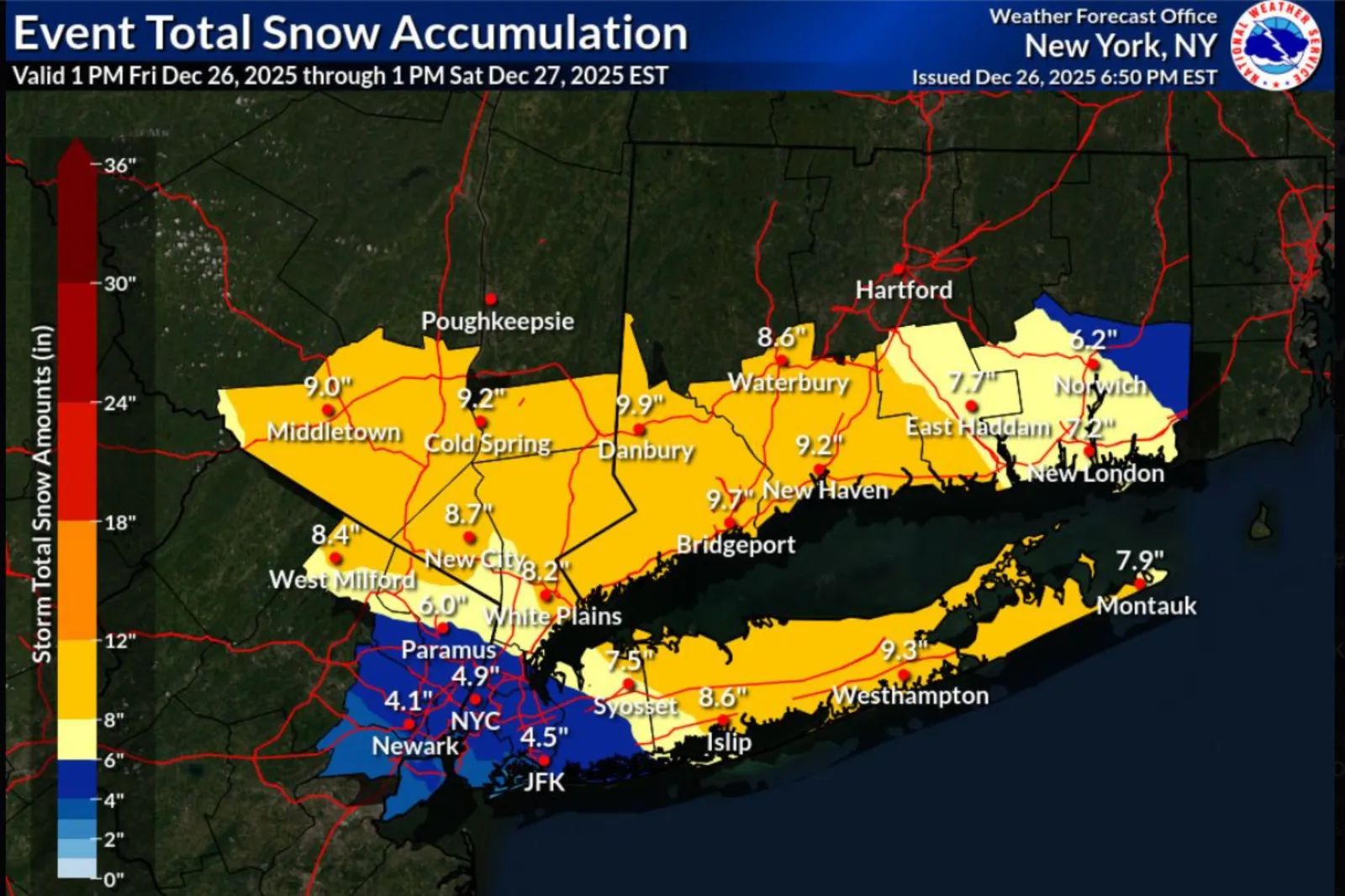
The winter storm hit the Northeast’s mid-Atlantic states on Friday, December 26. The storm brought up to 10 inches of snow in some areas, mainly hitting parts of New York, New Jersey, and Pennsylvania.
New York Governor Kathy Hochul issued a press release about the storm, which read: “New York is no stranger to snow and cold weather, and given the Christmas holidays, it’s important to be extra prepared before getting on the road.”
“As always, I urge New Yorkers to monitor their local forecast and text their county or borough name to our weather and emergency alerts system. Stay vigilant, drive slowly if you need to travel, and have a safe holiday weekend,” she added.
In the most recent forecast from the NWS, they said that snow and sleet accumulations in the New Jersey and New York City areas are expected to reach between two and five inches.
Accumulations could reach six inches in the northern parts of the metro area.
Freezing rain hit in the evening, producing a light ice glaze. Now, a wintry mix of snow and sleet will fall, blanketing the region across Saturday morning.
The NWS issues winter storm warnings when a “significant combination of hazardous winter weather is occurring or imminent.”
A winter weather advisory meanwhile is issued when there is any amount of freezing rain, or, when there is two to four inches of snow, either alone in combination with sleet and freezing rain. However, the advisory means that these conditions are expected to cause a significant inconvenience but are not serious enough to warrant a warning.
The warning comes as a record-breaking number of people have hit the road for the holiday season. The winter weather could spell trouble for the 122.4 million Americans projected by the AAA to travel.
Travel will slow down as Americans ring in the new year.
The winter storm warning is in place for the Tri-State area up until 1 p.m., Saturday, 27 December, 2025.