-
Microsoft Continues to Spend Big on A.I. While Profit Jumps 60% - 36 mins ago
-
Baby Food Recall Sparks New Warning to Parents Nationwide - 53 mins ago
-
San Jose State violated Title IX with transgender player, DOE says - about 1 hour ago
-
Meta Forecasts Spending of at Least $115 Billion This Year - about 1 hour ago
-
Tesla Profit Slumps, but Investors May Not Care - 2 hours ago
-
Tense exchange between LAPD deputy chief and police critic goes viral - 3 hours ago
-
The Havoc That One Disgruntled Student Can Wreak on a University - 3 hours ago
-
Mountain lion caught in San Francisco. ‘We locked eyes,’ resident says - 3 hours ago
-
Amazon’s $35 Million ‘Melania’ Promotion Has Critics Questioning Its Motives - 4 hours ago
-
Pasadena Jewish Temple sues Edison for igniting Eaton fire - 4 hours ago
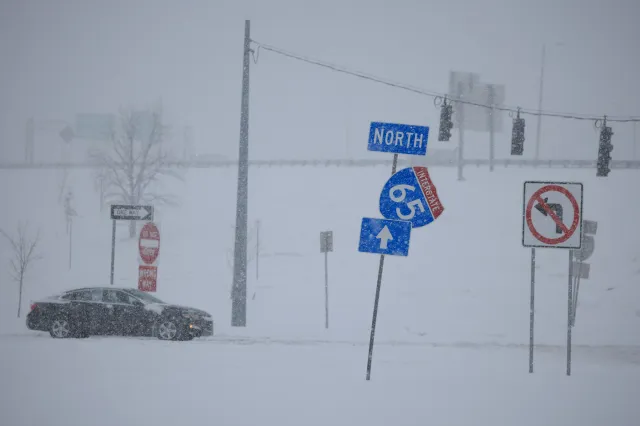
Winter Storm Poses ‘Very Rare’ Ice Warning for Several States
A winter storm aimed at impacting large swaths of the country comes with a “very rare” ice warning for numerous states, atmospheric scientist Matthew Cappucci said on social media Friday.
Meteorologists and public officials said the storm’s southern flank could endure a rare and damaging ice event capable of bringing down trees and power lines and causing prolonged power outages, while the northern sector braces for over a foot of snow in places.
Why It Matters
Ice storms are among the most destructive winter hazards because even a quarter inch of ice can snap tree limbs, down power lines and render roads impassable, while half an inch to an inch can cripple infrastructure and delay power restoration for days.
The storm threatens to strain energy systems as plunging temperatures boost heating demand and potential freeze-offs curb natural gas production.
What To Know
Cappucci said on X, in part, “CRAZY. Now up to 1.25 inches of ice expected! Anything over 0.5 inches is severe… this is next-level. Please prepare for long-duration power outages. Getting this amount of ice explicitly forecast is very rare. Vegetation impacts will be comparable to that of a Category 1-2 hurricane. We will also [see] SEVERE ice totals over 1 inch in northeast Louisiana.”
He added, “If you live in Corinth, Oxford, Clarksdale, Tupelo, Holly Springs, Grenada, Greenwood, Belzoni, Indianola or Cleveland, plan to have at least 72 hours without traveling. Prepare for power outages and procure the food, water, supplies and medicine you might need for 3+ days of isolation. Many roadways will be obstructed by fallen trees AND will be a skating rink. You will not be able to go anywhere for days!”
Millions of people are under winter weather alerts through Sunday, with states from Texas to the Carolinas preparing for severe icing and power outages and officials urging residents to avoid travel.
Emergency declarations covered a growing list of states and Washington, D.C., as leaders mobilized resources ahead of what state and local officials described as the most significant winter threat in years.
According to the National Weather Service (NWS), numerous states are facing an ice storm warning. Those include Texas, Louisiana, Arkansas, Mississippi, Tennessee, Alabama, Georgia, South Carolina and North Carolina.
Richard Bann, NWS meteorologist at the Weather Prediction Center, told Newsweek via phone on Friday that “There are certainly places where we could see over an inch of freezing rain. A couple places that stick out are northern Louisiana, Mississippi, the Tennessee Valley, and the Atlanta metro area.”
Bann added that “the amount of ice accretion isn’t unheard of but is unusual.”
What People Are Saying
Nashville’s FOX17 Chief Meteorologist Katy Morgan, on X Friday: “Cannot stress the importance in being prepared for ICE with this event. All signs pointing to ice accumulation, mainly beginning Saturday afternoon and lasting off/on through Sunday. Highest threat for ice impacts will be SW of Nashville, but even a 0.50″ of ice can be crippling”
Florida’s WFLA Chief Meteorologist Jeff Berardelli, on X Friday: “New hi-res IBM GRAF. Again for NYC-Philly-CT area to show snow-ice line. Steady as she goes. Sleet gets to NYC and stops short. Total accumulation through Monday AM at end. Not my forecast, just giving you access to the GRAF model.”
What Happens Next
Forecasters say the storm will shift east through the weekend, bringing heavy snow to the Midwest and Northeast and dangerous icing to parts of the South and Appalachians, followed by an Arctic blast that could drive wind chills to -50 degrees in portions of the Northern Plains.

Source link


