-
Cortina’s 70-Year-Old Curling Stadium Is a Star at the Winter Olympics - 4 mins ago
-
What to Know About the Homeland Security Shutdown - 49 mins ago
-
Liu, Sakamoto, Glenn? Predictions for Olympic Women's Figure Skating Gold - about 1 hour ago
-
2025 Film Independent Spirit Awards: Complete Winners List - 2 hours ago
-
Jutta Leerdam Makes Surprising Admission About Olympic Medal Win - 2 hours ago
-
See the Looks From the 2026 Film Independent Spirit Awards - 2 hours ago
-
Michael Silverblatt dead: ‘Genius’ host of KCRW’s ‘Bookworm’ was 73 - 3 hours ago
-
Diplomatic Feud With China Weighs on Japan’s Economy - 3 hours ago
-
USA Star Ilia Malinin Broke Social Media Silence With Subtle Change - 3 hours ago
-
In Munich, Lawmakers Concede Scars Remain After Trump’s Greenland Threat - 4 hours ago
Six States Brace for Snow Despite Warmer Temperatures
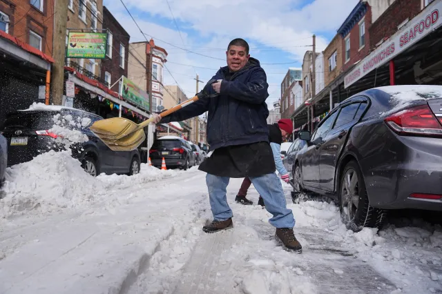
A storm is set to bring snow and a wet wintry mix to parts of the Northeast from Sunday night into Monday, according to AccuWeather forecasts.
The storm comes despite temperatures being significantly higher than recent weeks after extreme Arctic cold extended all the way into Florida, with six states expected to see winter weather impacts: West Virginia, Maryland, Virginia, Pennsylvania, New Jersey, and New York.
Expected Snowfall Amounts
A pocket of dry, chilly air will be in place from Saturday night to Sunday, which may limit how far north a southern storm with drenching rain can move.
However, the storm is expected to reach far enough north to bring a mixture of snow and rain to portions of West Virginia, Maryland, northern Virginia, and southern Pennsylvania. Mostly snow is forecast for eastern Pennsylvania, northern and central New Jersey, and coastal areas of New York, with parts of southeastern New England impacted as well.
A narrow strip of 1-3 inches is possible, especially on grassy and elevated surfaces, with an AccuWeather Local StormMax of 7 inches in the hardest-hit areas.
How far north the storm’s snow reaches will depend on the exact track and how the storm interacts with the cold, dry air across the region. A slightly stronger storm could mean the difference between non-accumulating wet snow and a few inches from north of Philadelphia to New York City.
Travel Impact Along I-95 Corridor
If snow remains intermittent and light along the Interstate 95 corridor, treated roads could remain wet. However, if it snows hard for a few hours, roads could become a slippery, slushy mess. Those with travel plans are encouraged to continue to check for updates as conditions could change rapidly.
AccuWeather meteorologists noted this storm does not appear to be a repeat of the major winter storm that left deep snow and sleet across the Northeast in late January.

Additional Weather Systems
A separate patch of light snow and flurries will occur well to the north of the southern storm from late Sunday to early Monday.
The St. Lawrence Valley, along with the Adirondacks and northern New England, will be affected by this weak storm system.
Warmer Weather Ahead
Beyond Monday, a new surge of Pacific air will move into the Northeast with perhaps some of the highest temperatures of the year ahead.
Source link


