-
Atlanta Dream Lose Brittney Griner Days After Angel Reese Trade: Report - 16 mins ago
-
F.A.A. Says Military Can Use Anti-Drone Lasers in U.S. Airspace - 23 mins ago
-
What the Cease-Fire Means for Iran - about 1 hour ago
-
Odds Eric Swalwell Drops Out Ahead of California Primary Surge - about 1 hour ago
-
Artemis II Splashdown Gives NASA Momentum in Renewed Moon Race - 2 hours ago
-
Eric Swalwell Releases Video Amid Sexual Assault Allegations - 2 hours ago
-
Ex-sheriff’s lieutenant among 5 charged in California fireworks blast - 2 hours ago
-
Fallout of War Piles Economic Pain Onto Europe’s Political Stress - 3 hours ago
-
How Lu Xun, a Famous Chinese Writer, Became a Cute Communist Mascot - 3 hours ago
-
Dianna Russini Sidelined as New Details Emerge Amid Mike Vrabel Rumors - 4 hours ago
Southern California Storm Could Bring Flooding, Possible Tornadoes
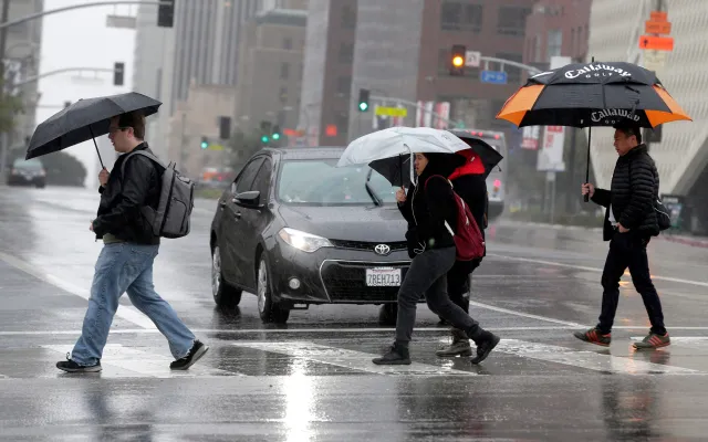
A powerful storm system is forecast to bring severe weather to Southern California starting Monday, with the National Weather Service (NWS) warning of potential tornadoes, 60 mph winds, flash flooding, and up to three feet of mountain snow.
The agency issued updated forecasts Sunday evening showing the storm has significantly strengthened, deepening nearly 1 millibar per hour as it approaches the region.
Storm Poses Multiple Simultaneous Threats
Two low-pressure systems are forecast to merge overnight Sunday into Monday, creating what forecasters describe as a rare combination of high precipitable waters, cold air aloft, and a strong atmospheric disturbance moving through the area.
The storm represents an unusually dangerous weather event for Southern California, with multiple simultaneous hazards threatening life and property across the region.
The timing of peak storm activity during Monday’s rush hour will compound travel dangers, while burn scar areas face a 20 percent chance of damaging debris flows. Rainfall rates potentially exceeding one inch per hour, combined with severe thunderstorms and possible tornadoes, create conditions rarely seen in the region.
Severe Weather Threats Monday
Peak activity will occur around Monday morning rush hour in San Luis Obispo and Santa Barbara counties, continuing through early evening in Ventura and Los Angeles counties. The cold front’s squall line will bring the most hazardous conditions as it moves through the region.
Rainfall rates of 0.5 to 0.75 inches per hour will be common, with local rates exceeding one inch per hour. Much of this rainfall could fall within 15 to 30-minute spans as the squall line passes. Forecasters warn of “heavy rainfall, enhanced damaging winds, and the chance for brief spin up tornadoes and/or water spouts to move onshore.”
Widespread winds with gusts up to 60 mph are expected, with high wind warnings and wind advisories covering most of the region. Thunderstorms carry a 20 percent to 40 percent chance, with severe storms including waterspouts and small tornadoes possible.
Rainfall and Flooding Risks
Total rainfall Monday is expected to reach 1 to 2.5 inches for coastal areas and valleys, and 2.5 to 5 inches in foothills and mountains. Isolated areas in favored south-facing locations could receive six inches, particularly in areas like Matilija in the Ventura Mountains and parts of the Santa Ynez Range.
A flood watch is in effect from 9 a.m. Monday to 9 p.m. Monday across much of Santa Barbara County, all of Ventura County, and all of Los Angeles County excluding the Antelope Valley. Rock and mud slides are possible near steep terrain, with debris flows possible on burn scars.
An evacuation warning will take effect from 9 p.m. Sunday through 9 a.m. Tuesday for the Palisades, Sunset, and Hurst burn scar areas due to the risk of mud and debris flows.
Mountain Snow and Travel Impacts
Snow levels will initially remain above 5,000 feet Monday, but a second, colder wave Tuesday night into Wednesday will drop snow levels rapidly to 3,000 to 4,500 feet. This will create significant travel hazards on Interstate 5 over the Grapevine, Highway 33, and other low-lying passes.
The Grapevine could see 3 to 6 inches of snow late Tuesday night as rain transitions to snow. Higher elevations above 6,000 feet could accumulate up to three feet of snow by Thursday.
A winter storm warning remains in effect for the Eastern San Gabriel Mountains and Northern Ventura County Mountains from 6 a.m. Monday to 9 a.m. Thursday.
Coastal Hazards
High surf advisories are in effect through Thursday, with waves of 12 to 16 feet expected Tuesday night into Wednesday.
Elevated high tides coinciding with the new moon cycle will increase coastal flooding risks, particularly during high tides Tuesday and Wednesday. A coastal flood advisory may be issued if current forecasts remain consistent.

What Happens Next
The storm will continue impacting Southern California through at least mid-week.
After Monday’s severe weather, isolated showers will continue Monday evening into Tuesday morning, with another wave bringing numerous showers and potential thunderstorms late Tuesday into Wednesday.
Residents are urged to monitor forecasts, sign up for alerts through NotifyLA.org, and avoid unnecessary mountain travel during hazardous conditions.
Source link


