-
The Wrath of Trump: House Republicans Map a Case Against Liz Cheney - 48 seconds ago
-
Nolan Arenado Blocks Trade To Perennial American League Contender: Report - 16 mins ago
-
Summer X Games are leaving Southern California, headed to Sacramento - 43 mins ago
-
Florida Charges Man Suspected of Trump Assassination Plot - 45 mins ago
-
Pardoning Oath Keepers Leader Stewart Rhodes Would Be ‘Frightening’: Judge - 51 mins ago
-
FBI agents search home of L.A. deputy mayor over City Hall bomb threat - about 1 hour ago
-
AAA Predicts Millions to Trave for Christmas Holiday. Here’s Everything You Need to Know - about 1 hour ago
-
What to Know About the Charges Against Luigi Mangione - about 1 hour ago
-
A Look At The Kardashian-Jenner Christmas Parties Through The Years - 2 hours ago
-
Zelensky to Meet With E.U. Leaders to Discuss Ukraine’s Future - 2 hours ago
Atmospheric River Update: Storm Could Hit 8 States on Christmas
What’s New
The National Weather Service (NWS) Climate Prediction Center shared a forecast that shows an increased chance for atmospheric river activity in the northwestern U.S. on and after Christmas, with up to eight states seeing impacts from the storm should it develop.
Why It Matters
The Pacific Northwest is known for its atmospheric rivers, particularly during the winter months. They bring heavy rain and snow, typically to Oregon, Washington and California. Though the moisture-laden storms can help alleviate drought, they also pose life-threatening risks from mudslides and floods.
Multiple storms have already hit the West Coast this month. One hit Washington and Oregon on Tuesday, with strong winds causing power outages for more than 100,000 people living along the Pacific coast.
Another few storms will barrel into the West Coast this weekend, with longer-term forecasts indicating that yet another atmospheric river could hit on the holiday.

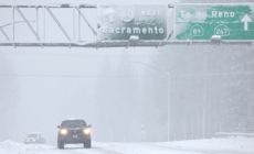
Mario Tama/Getty
What To Know
Atmospheric rivers are a “long, narrow region in the atmosphere—like rivers in the sky—that transport most of the water vapor outside of the tropics,” according to the National Oceanic and Atmospheric Administration.
According to the NWS Climate Prediction Center forecast updated on Tuesday, there’s a “moderate” risk with up to a 60 percent chance of heavy precipitation and mountain snow over parts of the Pacific Northwest and northern California from December 26 to 27.
Heavy snow could hit high-elevation areas in the northern Rocky Mountains and the northern Great Basin from December 25 to 28, and there’s a similar chance for “episodic high winds” across several states in the west beginning on Christmas and lasting through December 28.
A map included in the forecast shows high winds impacting Washington, Oregon, California, Idaho, Montana, Wyoming, Utah and Nevada.
What People Are Saying
NWS Weather Prediction Center meteorologist Brian Hurley told Newsweek: The three atmospheric rivers impacting the West through early next week are weaker storms, meaning they won’t last long or have widespread, significant impacts, Hurley said, adding that weather patterns indicate another atmospheric river could hit over Christmas.
NWS Climate Prediction Center in a Tuesday forecast: “Heavy precipitation and high winds could lead to localized flooding and landslides, particularly in regions that have recently received heavy rain. Travel conditions may be negatively impacted by unsettled weather.”
What Happens Next
The NWS Climate Prediction Center urged people to follow short-term forecasts, as details regarding the possible atmospheric river on Christmas are still unclear.
Meanwhile, two storms could collide in the Northeast, possibly posing hazards along the Interstate 95 corridor during the busy holiday travel period this weekend.
Source link


