-
Donor Expected to Admit to Making Illegal Contributions to Adams - 11 mins ago
-
Kendall Jenner Shows Off Her ‘Home at Christmas’ - 12 mins ago
-
Judge holds off on ordering shutdown of L.A. County’s juvenile hall - 31 mins ago
-
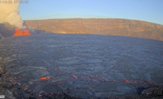
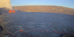
Volcanic Smog Threatens Hawaii as Kilauea Erupts Again - 47 mins ago
-
Trump’s Wish to Control Greenland and Panama Canal: Not a Joke This Time - 55 mins ago
-
Former US Marine to Be Extradited Over Alleged Training of Chinese Pilots - about 1 hour ago
-
Netanyahu Signals Progress on Hostage Deal but Won’t Give Timeline - 2 hours ago
-
This Hallmark Christmas Movie Is the Network’s Most-Watched Holiday Film of 2024 - 2 hours ago
-
Slovak Leader Visits Putin, Breaking With E.U.’s Policy of Isolation - 2 hours ago
-
Chiefs QB Patrick Mahomes Provides Big Update on Nagging Ankle Injury - 3 hours ago
California bomb cyclone brings record rain, major mudslide risk
An atmospheric river dumping rain across Northern California and several feet of snow in the Sierra was making its way across the state Friday, bringing flooding and threatening mudslides along with it.
The storm, the first big one of the season, moved over California as a bomb cyclone, a description of how it rapidly intensified before making its way onshore.
On Thursday, rain poured across the northern edge of the state, slowly moving south. It rained 3.66 inches in Ukiah on Thursday, breaking the record for the city set in 1977 by a half-inch. Santa Rosa Airport saw 4.93 inches of rain on Thursday, shattering the daily record set in 2001 of 0.93 inches.
More rain is due Friday.

Cars are covered in snow during a storm in Soda Springs.
(Brooke Hess-Homeier / Associated Press)
“Prolonged rainfall will result in an increased risk of flooding, an increased risk of landslides, and downed trees and power lines across the North Bay,” the National Weather Service’s Bay Area office wrote in a Friday morning forecast.
After its initial peak, the system is expected to linger into the weekend, with a second wave of rainfall extending farther south across most of the San Francisco Bay Area, down into the Central Coast and possibly reaching parts of Southern California.
On Saturday, Los Angeles and Ventura counties could see anywhere from a tenth to a third of an inch of rain. San Luis Obispo and Santa Barbara counties could see up to an inch in some areas.
A second round of rain expected to begin Sunday could be “a little stronger than the first but still likely in the ‘beneficial rain’ category,” the National Weather Service said in its latest L.A. forecast.
Chances are low of flooding or any other significant issues in Southern California, forecasters said, though roads could be slick and snarl traffic.
Staff writer Grace Toohey contributed to this report.
Source link


