-
Vikings’ JJ McCarthy Given Crushing Injury Prediction by Sports Doctor - 5 mins ago
-
‘Avatar’ Sequel Is Neither Fire Nor Ash at North American Box Office - 25 mins ago
-
Nicki Minaj takes stage with Erika Kirk, praises Trump and mocks Newsom - 27 mins ago
-
How to Watch Heat vs Knicks: Live Stream NBA, TV Channel - 40 mins ago
-
Immigration Crackdown Creates Fault Lines Among Baptists - about 1 hour ago
-
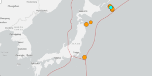
Multiple Earthquakes Rattle Japan: What to Know - about 1 hour ago
-
Prices jump 56% for Airbnbs in L.A. during the World Cup - 2 hours ago
-
Corgi and Dachshund Have Puppies, Owner Shares Adorable Result - 2 hours ago
-
Australia Mourns Bondi Beach Shooting Victims - 2 hours ago
-
Starbucks Workers Take Protest to Corporate HQ: ‘Watch This Space’ - 2 hours ago
Christmas travel warning for thousands as four feet of snow to strike
Thousands of Americans have been issued a Christmas travel warning by the National Weather Service (NWS), with up to four feet of snow forecast to fall during the busy holiday period.
Holiday travelers heading through California’s Sierra Nevada and southern Cascades face major disruptions as a powerful winter storm is set to blanket the region with heavy snow from Tuesday night through Friday morning.
Flooding is also expected to disrupt travel as the combination of heavy precipitation, wintry conditions, and high winds poses a serious threat to road safety and infrastructure just as travelers plan to gather for Christmas celebrations.

What To Know
A NWS winter storm watch has been issued across parts of California from Tuesday evening through Friday morning for elevations above 5,500 feet, warning of up to one foot of snow at lower mountain passes and as much as four feet at the highest peaks.
Gusty southwest winds could reach 45–50 mph, creating dangerous whiteout conditions.
According to the NWS forecasting office in Sacramento, parts of the Sierra Nevada, western Plumas County, and Lassen Volcanic National Park will see significant snowfall.
The harsh weather could trigger chain controls, possible road closures, reduced visibility, and hazardous driving conditions. Severe travel delays on Interstate 80 and Highway 50 are likely.
A flood watch also remains in effect for the Sacramento Valley, northern San Joaquin Valley, the Sierra foothills, and the Coastal Range from 4 p.m. PT Saturday through next Friday. These are driven by a series of potent Pacific storms predicted to bring heavy rainfall and the risk of flash floods.
Impacts from the flooding could include rockslides, mudslides in foothills and mountains, flooding in susceptible urban and low-lying areas, the NWS warned.
Officials strongly advise delaying travel if possible. “Travel could be very difficult to impossible,” the NWS said, urging drivers to carry winter emergency kits if travel is unavoidable.
What People Are Saying
The NWS says: “Snow accumulations will remain near or above pass level through Tuesday, then drop to around 5,500 feet during the day Wednesday.
“Roads, and especially bridges and overpasses, will likely become slick and hazardous. Travel could be very difficult to impossible. The hazardous conditions could impact the Tuesday evening and Wednesday morning commutes.”
The NWS adds: “Never drive across flooded roads. Be aware if living near streams and creeks, and have an evacuation plan and emergency kit.”
What Happens Next
Travelers have been told to check real-time road conditions at or dial 511. Prepare for extended delays and consider alternate plans to avoid mountain routes during the storm.
Source link


