-
Panama Court Strikes Down Hong Kong Firm’s Canal Contract - 12 mins ago
-
Dr. Oz accused L.A. Armenians of fraud. Newsom files civil rights complaint - 48 mins ago
-
Trump Expected to Announce Kevin Warsh as Fed Chair - 56 mins ago
-
NBA Announces Historic Cooper Flagg News After 49-Point Performance - about 1 hour ago
-
Trump and First Lady Attend Premiere of ‘Melania’ at Kennedy Center - 2 hours ago
-
Trump Sues I.R.S. Over Tax Data Leak, Demanding $10 Billion - 2 hours ago
-
Dodgers Signing Hurler to Potential $800K Deal: Report - 3 hours ago
-
Brendan Banfield Denies Plot in Double Murder Trial, Calling Accusations ‘Crazy’ - 3 hours ago
-
Disneyland Ride Breaks Down—How Passengers ‘Risk Getting Banned’ Shocks - 3 hours ago
-
Ray Kappe’s Modernist masterpiece asks $11.5 million in Pacific Palisades - 4 hours ago
Colorado Winter Storm Warning Map Shows Where 17 Inches of Snow Possible
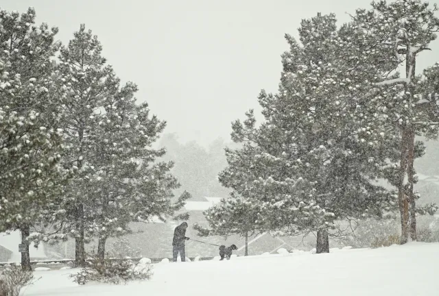
Up to 17 inches of snow is possible for portions of Colorado on Wednesday and into Thursday, the National Weather Service (NWS) warns, adding that “Travel could be very difficult to impossible.”
Why It Matters
This weather system is expected to create hazardous travel conditions, particularly along key commuter routes such as Interstate 25, and could potentially exacerbate travel challenges for local communities. Residents, travelers and businesses are being urged to prepare for the storm’s impacts, including dangerous roads and possible disruptions in daily routines.
What To Know
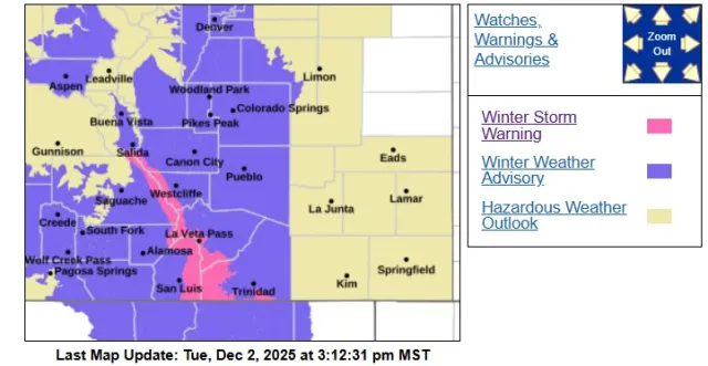
According to the NWS, the Sangre de Cristo Mountains are impacted, including Stonewall, Cuchara, Blanca Peak, Weston, La Veta Pass, Spanish Peaks and Poncha Pass.
“Heavy snow expected,” the NWS says, with accumulations of 10 to 17 inches possible. The warning goes into place at 8 a.m. local time Wednesday and continues until 2 a.m. Thursday.
Surrounding areas are under a winter weather advisory, including Wet Mountains, Wet Mountain Valley, Walsenburg vicinity and Upper Huerfano River Basin below 7,500 feet, Trinidad vicinity and Western Las Animas County below 7,500 feet, the NWS says.
The cities of Pueblo, Colorado Springs, Denver and Aspen are all under the advisory, which begins at 2 a.m. Wednesday as well.
Below is a map of the impacted areas:

What People Are Saying
NWS Pueblo on X on Monday: “Here’s an early look at forecast mid week snowfall amounts. If traveling across the area Wed into Thu, expect slick and snow-packed roads, especially for the I-25 commute to Denver Wed morning, then across most locations for the drive home Wed evening. #cowx”
NWS Meteorologist Brian Hurley told Newsweek via phone on Tuesday about snow accumulations for portions of the state: “Those types of accumulations are impactful. 4-6 inches is more like an advisory to them [residents in the area].
“Snow accumulation is the biggest concern here as winds I don’t see being the most impactful. Highest winds are between 5 to 10 miles per hour in the Denver area.”
What Happens Next
The NWS says that people “should consider delaying all travel” amid the winter storm warning, but “if you must” they advise that you keep water, food and a flashlight in your vehicle “in case of an emergency.”
Travelers looking for the latest road conditions in their state can also call 511, the NWS says.

Source link


