-
The Mobile, Ala., Leprechaun Lives On 20 Years Later - 38 mins ago
-
Southern California’s heat wave hasn’t peaked yet and it’s already breaking records - about 1 hour ago
-
Hundreds Dead in Pakistani Airstrike on Kabul, Officials in Afghanistan Say - about 1 hour ago
-
Joe Kent, a Top Counterterrorism Official for the Trump Administration, Resigns, Citing Iran War - 2 hours ago
-
Laughter As Cat Owner Spends $1,500 on Vet Visit—Then Reveals ‘Diagnosis’ - 2 hours ago
-
Suspending gas tax, reducing refinery regulations pushed by two Democrats running for governor - 3 hours ago
-
2026 NCAA Men's Tournament Bracket Picks: Arizona To Cut Down Nets 📩 - 3 hours ago
-
M.T.A. Sues Trump Administration to Release 2nd Avenue Subway Funding - 3 hours ago
-
What ‘One Battle After Another” doesn’t get about resistance in Trump’s America - 3 hours ago
-
Sucked Into War, Gulf Countries Face the Limits of U.S. Security Guarantees - 4 hours ago
Heavy Rain Brings New Flood Threat to Washington
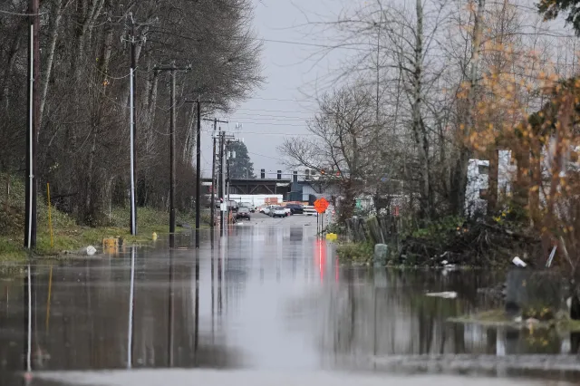
Washington state faces a renewed threat of flooding this week as an atmospheric river system is forecast to bring several inches of rain across the region that saw deadly flooding last month.
The storm system also brings a heightened risk of mudslides, avalanches, and dangerous surf conditions. Two people died and two others were rescued after an avalanche swept through the backcountry near Longs Pass in North Kittitas County on Saturday.
An atmospheric river, carrying moisture from near Hawaii and known locally as a Pineapple Express, struck Western Washington late Saturday and is expected to last through at least Monday night, according to the National Weather Service (NWS).
“Moderate to heavy rain will continue over the Olympics into Monday. This will push the Skokomish River above flood stage later today…Turn around, don`t drown when encountering flooded roads. Most flood deaths occur in vehicles. Motorists should not attempt to drive around barricades or drive cars through flooded areas,” NWS said in its Sunday advisory.
Rainfall totals were projected at 2–5 inches in mountain areas, 1–3 inches along the coast, and about 1 inch across the Puget Sound lowlands. Most precipitation in the mountains was anticipated to fall as rain rather than snow, driving snow levels as high as 8,000 feet by Monday, according to the forecast.
The Skokomish and Bogachiel rivers have been identified as being at particular risk. The Skokomish River is projected to potentially crest near 17.5 feet by Monday afternoon—above its flood stage of 16.5 feet.
In the northern counties of Whatcom and Skagit, rivers like the Nooksack are also projected to rise sharply, potentially reaching “action stage,” with outcomes dependent on how much rain would be absorbed by snowpack versus causing runoff, the Bellingham Hearld reported.
Heavy rains have also raised concern for flash flooding in urban corridors, including the Interstate 5 corridor near Seattle and Bellingham, along with the Vancouver, British Columbia, metro area.
The NWS also issued a beach hazards statement through Monday for the Southwest Washington coast, warning of sneaker waves capable of sweeping beachgoers into the ocean.
NWS said its next update will be set for 7 p.m. Pacific Standard Time.

Source link


