Heavy monsoon rains across Southeast Asia in recent weeks have turned Sumatra, Indonesia’s westernmost island, into one of the hardest-hit areas, in a recurring natural disaster that appears to be worsening by the season.
The death toll on the island of 60 million people from a rare cyclone, which triggered floods and landslides, rose to nearly 850, with hundreds still missing, authorities said. Environmental groups say rampant deforestation has exacerbated the devastation in Sumatra.
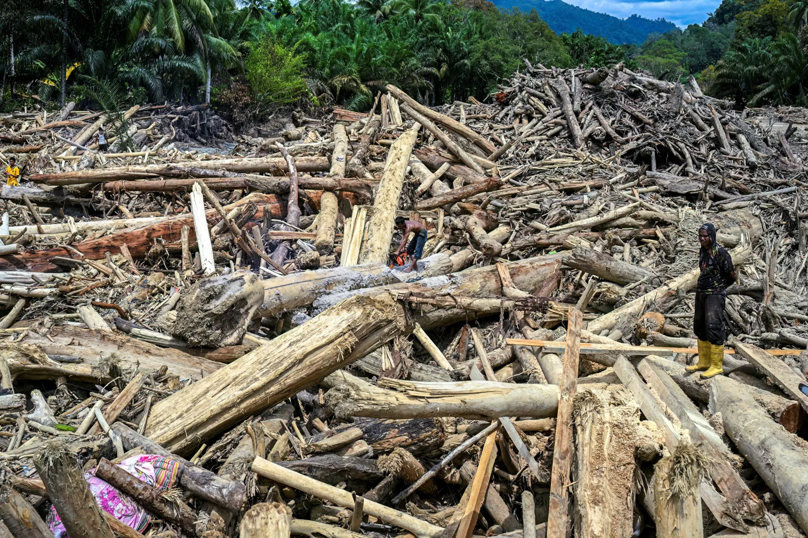
Logging and the clearing of forests for plantations and mining have stripped the earth of its protective cover. Photographs taken in several disaster areas showed huge piles of logs washed downhill by flash floods pouring off denuded slopes.
In the Sorkam subdistrict of North Sumatra, the widespread devastation was visible from space. Imagery captured by the European Space Agency’s Sentinel-2 satellites on Wednesday showed burst riverbanks carrying sediment and other debris into Indian Ocean, and signs of flooded farmland throughout.
Landslides have blocked and severed roads, swept away bridges and cut lines, hampering rescue efforts. About 80,000 people were forced from their homes into temporary shelters.
“What unfolded was not only a natural disaster but a collision between an exceptional climatic cycle and a landscape steadily stripped of its natural defenses,” said Ronny P. Sasmita, a senior analyst at the Indonesia Strategic and Economics Action Institution, a Jakarta think tank.
Meteorologists had warned of warmer ocean temperatures increasing rainy season downpours, but the formation of Cyclone Senyar over the Strait of Malacca, off Sumata’s east coast, compounded the weather disaster.
“What might have once been manageable seasonal extremes became lethal when these torrents met degraded catchments and eroded hillsides,” Sasmita wrote in a commentary for the website Climate Home News.
“Heavy rain alone does not create walls of mud and logs crashing into villages, it is heavy rain falling on land that is no longer able to hold or aboard it.”
Indonesia experienced a significant increase in deforestation in 2024, with approximately 175,400 hectares of forest cover lost, a rise of 54,300 hectares from the previous year, The Jakarta Post newspaper reported in March, citing data from the country’s Forestry Ministry.
Much of the loss happened in Sumatra, where 4.4 million hectares of forest have been lost since 2001, according to David Gaveau, founder of deforestation monitor Nusantara Atlas. That’s an area larger than Switzerland.
Indonesian authorities said on Thursday that an investigation had been launched into companies suspected of clearing forests in flood-hit areas in Sumatra.
Forestry Minister Raja Juli Antoni told parliament the government would review forest governance, consider a moratorium on new permits and revoke the licenses of violators. Bahlil Lahadalia, the country’s energy minister, also signaled mining permits could be scrapped if rules were breached.
Parts of neighboring Thailand and Malaysia, to the east, and Sri Lanka, to the west, have also been hit by extreme weather in Southeast Asia in recent days, with hundreds of people killed.