What to expect along California coast when tsunami waves arrive
July 30, 2025
3,724
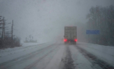
In the next few hours, the California coast will experience impacts from the massive quake that hit off Russia’s eastern coast.
Officials estimated that wave size in Southern California would be modest.
But in the north, the waves could be larger. Authorities in Northern California have urged people not to go to the beaches but have not issued evacuations.
Here is what to expect:
Size of waves
Officials estimated that wave size in Southern California would be modest, and if those predictions hold, waves are unlikely to cause major problems. But in the north, the waves could be bigger.
The largest impact is expected in Crescent City in Del Norte County, where waves of up to 4.8 feet are predicted.
Waves of up to 3.7 feet are predicted in Port San Luis in San Luis Obispo County. The rest of the California coast is predicted to see waves of 1.3 feet or less, with waves in Los Angeles expected to be less than 1 foot.
Timing
Should a tsunami materialize, it would hit Fort Bragg in Mendocino County at 11:50 p.m. Tuesday and Crescent City in Del Norte County at 11:55 p.m.
Then, in the early hours of Wednesday morning, potential waves would reach Monterey at 12:15 a.m., San Francisco at 12:40 a.m., the Los Angeles harbor at 1:05 a.m., Newport Beach at 1:10 a.m., and Oceanside and La Jolla at 1:15 a.m.
Warnings
So far, no evacuations have been issued.
In the San Francisco Bay Area, officials from San Mateo and Alameda counties urged people to stay out of the coastal waters and beaches until the tsunami advisory is lifted. But no evacuation order was issued.
The Humboldt County Office of Emergency Services urged people to move out of the water, off the beach and away from harbors.
Where are California’s tsunami hazard zones?
Tsunami hazard zones can extend to bayside and riverside areas relatively far from the Pacific coast.
Zoom in and move the map to see the state’s tsunami hazard areas
When tsunami waves hit in 2022, California experienced relatively minor effects. But at Santa Cruz Harbor, waves flooded streets and a parking lot, where cars floated about like toy boats. Water poured into bathrooms and electrical transformers onshore. It caused an estimated $6 million in damage to Santa Cruz alone, officials later said.
In 2011, a tsunami from the devastating Japan earthquake also battered some coastal areas of California, resulting in more than $100 million in damage at marinas and harbors, state officials estimate. In Crescent City, residents reported that about three dozen boats were “crushed” in the harbor and that surging waters significantly damaged or destroyed many docks.
One person died after being swept into the sea, reportedly while taking pictures of the tsunami.
In 2006, Crescent City residents were caught off guard by significant seawater surge hours after a tsunami warning expired, causing significant harbor damage.
Most notably, the Alaska earthquake of 1964 set off a catastrophic tsunami that devastated Crescent City, washing away 29 city blocks and killing at least 11 people. A series of nighttime waves crashed through the coastal city, destroying or damaging 91 houses and 172 businesses.
California officials also have records of tsunamis hitting Northern California in 1960 and 1946, which each left at least one person dead. The 1946 tsunami, triggered by an 8.6-magnitude earthquake near Alaska, flooded parts of Half Moon Bay.
Among the earliest records of a tsunami in California is an event in 1812 when a large earthquake in the Santa Barbara area “was followed by a tsunami that wiped out many coastal villages and destroyed ships in the harbor,” according to the U.S. Geological Survey.
Preparation
Look out for tsunami hazard maps in your area. If maps or signs are not available, state officials suggest getting to an area 100 feet above sea level or two miles inland. “If you cannot get this far, go as high as possible. Every foot inland or upwards can make a difference,” state officials say.
The National Weather Service operates two tsunami warning centers, with a goal of monitoring for tsunamis and the earthquakes that may cause them, to send tsunami alerts. To get official notifications of a tsunami warning, sign up for text message alerts from your local government, get a battery-powered National Oceanic and Atmospheric Administration weather radio, or listen for TV, radio or automated telephone announcements.
Sign up for alerts here:
Officials urge people not to go to the coast to see the tsunami, and noted that you can’t surf a tsunami.
“You can’t surf a tsunami, because it doesn’t have a face” — where the surfboard grips a wave — according to the University of Hawaii. In 2022, San Francisco firefighters had to rescue experienced surfers from the incoming tsunami.
That tsunami caused about $11.5 million in damage to harbor infrastructure, waterways and boats in California, the California Geological Survey has said.
Um die besten Erfahrungen zu bieten, verwenden wir Technologien wie Cookies, um Geräteinformationen zu speichern und/oder darauf zuzugreifen. Wenn Sie diesen Technologien zustimmen, können wir Daten wie das Surfverhalten oder eindeutige IDs auf dieser Website verarbeiten. Die Nichteinwilligung oder der Widerruf der Einwilligung kann bestimmte Merkmale und Funktionen beeinträchtigen.
Functional
Always active
The technical storage or access is strictly necessary for the legitimate purpose of enabling the use of a specific service explicitly requested by the subscriber or user, or for the sole purpose of carrying out the transmission of a communication over an electronic communications network.
Preferences
The technical storage or access is necessary for the legitimate purpose of storing preferences that are not requested by the subscriber or user.
Statistics
The technical storage or access that is used exclusively for statistical purposes.The technical storage or access that is used exclusively for anonymous statistical purposes. Without a subpoena, voluntary compliance on the part of your Internet Service Provider, or additional records from a third party, information stored or retrieved for this purpose alone cannot usually be used to identify you.
Marketing
The technical storage or access is required to create user profiles to send advertising, or to track the user on a website or across several websites for similar marketing purposes.