-
Miami (OH) Goes Perfect 31-0 Amid ‘Disgusting’ Ending With Trash Thrown - 5 mins ago
-
Trump Calls On Private Companies to Take On a Bigger Role in Cyber - 7 mins ago
-
Surfers in Munich (Yes, Munich) Just Want Their Wave Back - 51 mins ago
-
For Xi, Trump’s Embrace of War Proves China Needs More Power - 2 hours ago
-
Ravens’ Trade for Maxx Crosby Was Historic for One Reason - 2 hours ago
-
Appeals Court Upholds Protected Status for 350,000 Haitians - 2 hours ago
-
Divisive F.D.A. Vaccine Regulator Is Resigning - 3 hours ago
-
Fans Convinced Lamar Jackson Knew About Maxx Crosby Trade Before It Happened - 4 hours ago
-
Vulnerable California Republican Darrell Issa Drops Re-election Bid - 4 hours ago
-
Kristi Noem Survived Many Crises. Then She Crossed a Trump Red Line. - 5 hours ago
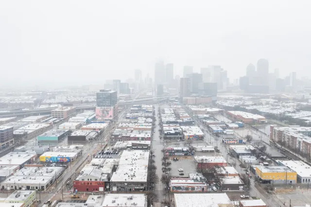
Winter Storm Warning as Snow and Ice to Hit Texas
Meteorologists are warning an incoming winter storm could hit Texas with ice and snow at the end of this week.
The forecast comes after the Southeast saw abnormally low temperatures last Friday and again on Monday, with cold-related weather alerts issued across nearly the entire state of Florida.
Some parts of the Southeast picked up rare snow over the weekend. Now, there’s a chance cold temperatures, snow, and ice will affect a wide swath of the U.S. from Texas through Virginia later this week, FOX Weather reported, with Texas and other Gulf Coast states at risk of ice.
In 2021, Winter Storm Uri swept through the region, killing at least 246 people and causing extensive power outages for Texans amid an ice storm and freezing temperatures. In the years since, the Electric Reliability Council of Texas (ERCOT) has undergone improvements. Despite the concerning outlook with this week’s potential storm, ERCOT said it would be able to handle the upcoming demand on the Texas electrical grid.

“The ERCOT grid is operating under normal conditions, and ERCOT will continue to monitor conditions through next week,” the council said in a statement, according to a report by Houston Public Media.
Newsweek contacted ERCOT by email for comment.
Although the storm’s path and impact is uncertain given it is still days away, FOX Weather reported that rain would fall south of the storm’s path, snow to the north, with harmful ice likely in between.
“It is far too early to assess the severity of any ice threat, but the pattern warrants close attention, as this is a classic setup for disruptive icing due to the combination of deep moisture and cold air,” said the FOX Forecast Center in a report.
Meteorologists posted early model guidance across social media, commenting on the winter storm potential.
“A RARE Southern US Winter Storm is becoming more likely for Friday-Sunday, with significant snow and ice possible in Texas, Oklahoma, and across the Southeast,” account Max Velocity posted on X on Monday morning, sharing a screenshot of the European Centre for Medium-Range Weather Forecasts (ECMWF) model.
“Lots of details to work out here, but now is the time to be WEATHER AWARE. No need to panic buy all the toilet paper right now, as who sees snow and ice and WHERE this sets up is still a question.”
“Next weekend, Texas will have so many different colors on weather maps for snow, rain, freezing rain, and sleet with temperatures determining the mixture of frozen slop,” X-user Ryan Maue posted alongside a screenshot of the Global Forecast System (GFS) weather model.
“Potential of crippling sleet and freezing rain late Friday into Sunday from Dallas to Houston.”
While it is too early for National Weather Service (NWS) offices to release winter storm warnings for the system, the NWS office in Fort Worth, Texas, did post messaging about the possibility on its website.
“Confidence is increasing regarding the potential for a significant intrusion of Arctic air and impactful wintry precipitation from Friday into the upcoming weekend,” said the office. “Monitor the forecast closely over the next several days as we fine tune the details and start thinking about how you can Protect the 4 P’s: People, Pets, Pipes, and Plants.”
NWS Amarillo also commented on the chance of snow later in the week.
“Low chances of showers returns Friday and Saturday with the arrival of a new system,” NWS Amarillo said in a hazardous weather outlook. “This system is also expected to bring much colder temperatures with lows potentially in the single digits.”
Source link


