Multiple states across the country had been issued advisories for wintry weather by the National Weather Service (NWS) as of early Thursday, including much of the Northeast as well as Alaska and Colorado.
Why It Matters
The NWS cautioned that in Alaska, multiple inches of snow could lead to hazardous driving conditions, while in the Northeast frost and freeze conditions could damage outdoor vegetation.
What To Know
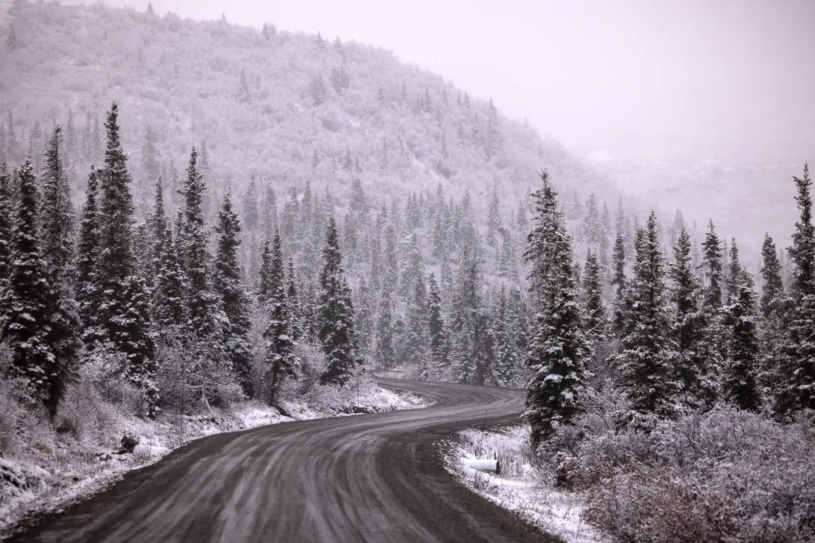
Winter weather advisories have been issued in central Alaska for the Chena Hot Springs Resort area and areas along Chena Hot Springs Road east of milepost 34, with between 3 and 5 inches of snow expected.
Another advisory had also been issued for areas along the Steese Highway, up to around mile marker 90, and the higher elevations of the White Mountains, where up to 6 inches of snow could accumulate.
“Plan on slippery road conditions. The hazardous conditions could impact the Thursday evening and Friday morning commutes,” read the alerts, which were in force from 2 p.m. Thursday to 10 p.m. AKDT Friday.
Meanwhile, freeze warnings spanned parts of New York, Vermont, and New Hampshire, where sub-freezing temperatures in the upper 20s and low 30s are expected, according to notices in effect until Thursday morning as of reporting.
“Frost and freeze conditions could kill crops, other sensitive vegetation and possibly damage unprotected outdoor plumbing,” the NWS cautioned.
Additionally, frost advisories had been issued for parts of northern and central Pennsylvania, southern Maine, western Massachusetts, and the central and southern San Luis Valley in Colorado, where the NWS said temperatures in the 30s could result in frost formation that posed a risk to outdoor vegetation.
What People Are Saying
The National Weather Service forecast office, Fairbanks, Alaska said on X, Tuesday: “Moderate to heavy snowfall is expected for the White Mountains, with the highest amounts reaching the Steese and Eagle Summits and Upper Chatanika Valley Thursday evening into Friday night. Mixed precipitation is expected at lower elevations.”
Mark Pellerito, with the NWS Binghamton, New York, forecast office, told Newsweek on Wednesday: “Thursday night will still be quite chilly, with some lower to mid-30s in the coldest locations [in NWS Binghamton’s forecast area]. It would be reasonable to anticipate that many of the current freeze warning counties could end up with at least a frost advisory for Thursday night.
“After Thursday night, we will be in a warmer spell and so no frost/freeze conditions through the weekend through at least the middle of next week. In fact, widespread 70s to near 80 are forecast for highs this weekend under full sunshine.”
NWS Burlington, Vermont, said on X, Wednesday: “A freeze warning and frost advisory is in effect for parts of the region tonight. Minimum temperatures will be cold enough overnight for frost formation and even a hard freeze in parts of our region.”
What Happens Next
Regional NWS offices issue regular forecast updates on the agency’s website and social media channels.